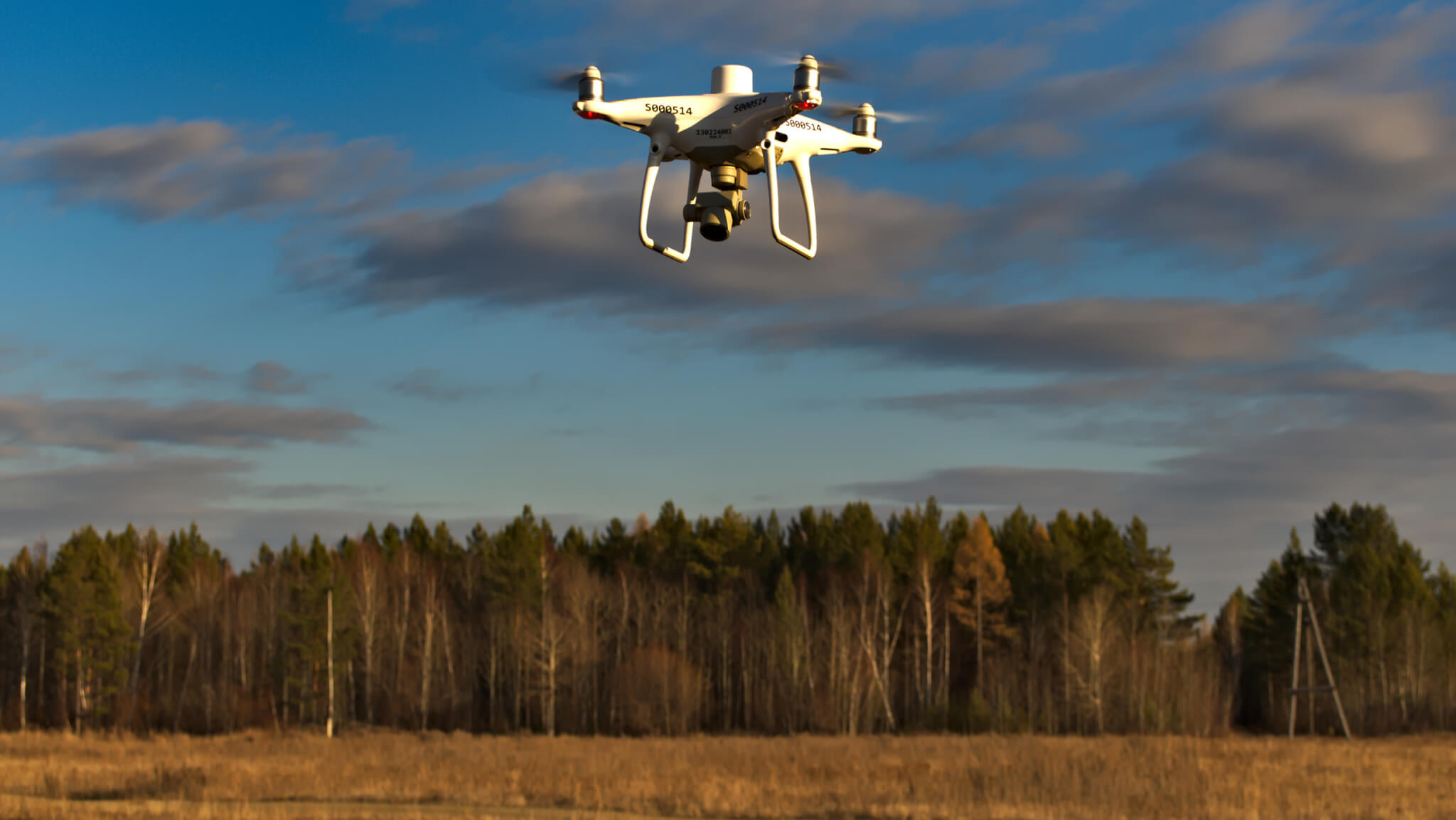
In our tech-driven age, it comes as no surprise that more and more companies are using drones for geographical mapping and data collection purposes.
However, selecting a drone for building maps and collecting data isn’t easy. After all, there are many factors to consider. One of the major challenges businesses face when they’re selecting a drone is choosing between photogrammetry, and light detection and ranging (LiDAR) technology.
With that in mind, let’s take a closer look at drone photogrammetry and examine why many companies are choosing to use it for their surveying needs.
What Is Drone Photogrammetry?
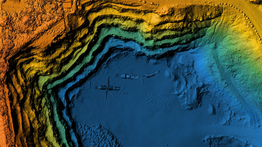
In short, drone photogrammetry involves capturing large volumes of 2D images over a geographical area and compiling them to create 3D topographical models and orthomosaic maps—or images created from collections of photographs.
In effect, drone photogrammetry makes it possible to see the same ground point from different angles and elevations. From there, you can easily create a 3D map that includes a range of helpful visual cues, like color and texture.
Photogrammetry is several decades old. Even so, companies are increasingly using it with drones to produce high-quality surface maps for public and private lands.
In effect, drone photogrammetry makes it possible to see the same ground point from different angles and elevations
How Does Drone Photogrammetry Work?
In a typical photogrammetry deployment, you fly a drone over a target area and take a photograph every few feet. To ensure that you get an accurate representation, it’s important to use a full-frame sensor camera that can take high-resolution photos.
After that, you funnel the data into photogrammetry software, which takes the various photographs and compiles a 3D map of the surrounding area. This eliminates back-end work, resulting in a highly accurate representation that is fit to scale.
Drone photogrammetry requires very little labor apart from flying the drone and capturing images. It doesn’t require any advanced knowledge of drones, photography, or software. As such, this is an ideal approach for drone operators of all experience levels.
Photogrammetry vs. LiDAR
LiDAR is another technology that companies sometimes use to map geographical areas. Unlike drone photogrammetry, which captures high-resolution images with cameras, LiDAR utilizes laser scanning—or 3D scanning—to capture surrounding images.
In a typical LiDAR drone deployment, the sensor will send pulsed light waves into the local area. The light waves reflect off the ground and return to the sensor on the drone. The system then measures the time of the return pulse in order to calculate the total distance and generate an image.
In general, LiDAR is more effective in areas with heavy ground cover, such as forested regions. LiDAR can penetrate small spaces and reach ground level. On the other hand, photogrammetry can only capture visual representations of underlying topography—meaning the tops of trees and other objects. LiDAR is also better for low-light and night surveying purposes.
However, LiDAR is also more expensive and complicated than photogrammetry, and it requires experts who know how to use the technology. What’s more, LiDAR images are very rudimentary compared to photogrammetry renderings. So, if you are looking for high-quality images, then photogrammetry may be the better choice.
As you can see, it isn’t a matter of saying that one technology is better than the other. It largely depends on what you are trying to accomplish and your specific needs for each project.

Why Use Drone Photogrammetry?
Photogrammetry can be a useful tool for surveying purposes, leading to the following benefits.
Reduce Risk
First, photogrammetry-enabled drones make it easy to capture data in areas that are hard to reach or unsafe for surveying crews. Examples may include places with heavy volcanic activity, crime or warfare, difficult terrain to navigate, and adverse weather conditions.
Drones allow you to capture images safely from above and securely transmit the information to computer systems. This reduces the likelihood that anyone on your team gets injured.
Collect Data Faster
Second, photogrammetry allows you to collect data quickly and efficiently. Photogrammetry systems can capture images, process data, and rapidly create 3D renderings.
This makes photogrammetry useful in settings where quick land surveying is necessary. If your team is short on time, photogrammetry can come in handy.
Drones allow you to capture images safely from above and securely transmit the information to computer systems. This reduces the likelihood that anyone on your team gets injured
Obtain Accurate Measurements
Third, photogrammetry creates highly accurate images, making it a reliable source of data collection.
Top Uses Cases for Drone Photogrammetry
New use cases are constantly emerging for photogrammetry as companies increasingly integrate drones into their operations.
Here are some common ways that companies across different industries are using drone photogrammetry to accomplish various tasks.
Urban Planning
Construction and landscaping teams often use photogrammetry to create accurate 3D models of public spaces. Companies then use these images to study urban landscapes and influence new designs.
What’s more, drone photogrammetry is useful in congested public spaces, as well as places that are otherwise inaccessible via satellites and crewed aircraft.
Utilities
Utility companies often use photogrammetry to survey infrastructure across remote areas. Drones make it possible to monitor topographical changes that can impact infrastructure and lead to potential safety hazards—like shifting rivers and tree growth.
This also reduces truck rollouts and, in turn, saves money and reduces environmental impact.
Agriculture
Farmers use photogrammetry to capture images of crops and keep tabs on their land as it changes over time.
This is particularly useful for companies managing large areas of land. Drones can help identify issues like erosion and crop disease.
Environmental Monitoring
There is also strong demand for photogrammetry among environmental groups like forestry services. Organizations use photogrammetry to study issues like invasive plant growth and wildfire risk. Photogrammetry data can help predict future events and aid in post-disaster recovery missions after events like hurricanes and floods.
Law Enforcement
Many law enforcement agencies use drone photogrammetry to capture data to aid in crisis situations.
This data can help plan evacuation routes and help first responders navigate different environments. Photogrammetry is also useful for surveillance and military planning.
BVLOS and Photogrammetry: A Winning Combination
One of the major issues that companies today are struggling with is a lack of drone range.
Even though drones are legal for commercial purposes, they still require operators to maintain a visual line of sight (VLOS) with their aircraft. This can limit how far drones can travel, making it hard to capture large-scale photogrammetry diagrams.
The trick is to adopt “beyond visual line of sight” (BVLOS) and enable your drones to travel to areas where the operator can’t see the craft. For example, a BLVOS operation would allow you to fly a drone around a mountain, behind a building, or at a distance where it’s beyond your immediate line of vision.
Combining BVLOS and photogrammetry is an excellent option for organizations that need to survey large areas of land or those that operate in areas that have many obstructions.
How Iris Automation Can Help
In order to fly BVLOS drones, you need to acquire special permission from the Federal Aviation Administration. This can be a difficult and time-consuming process.
Iris Automation can help through advanced onboard detect-and-avoid BVLOS technology. Iris offers Casia, a high-quality collision avoidance technology that makes it possible to fly BVLOS in a way that is safe and secure. In addition, Iris Automation can help ensure BVLOS regulatory approval through an accelerated process.
Add it all up, and with the help of Iris, you can start using photogrammetry over greater distances. This can expand your surveillance operations and enable stronger mapping capabilities.
To learn more about how companies are using Iris Automation to power their operations, check out these use cases.
This post was written by Justin Reynolds. Justin is a freelance writer who enjoys telling stories about how technology, science, and creativity can help workers be more productive. In his spare time, he likes seeing or playing live music, hiking, and traveling.

